


Tašmajdan Miocene Reef
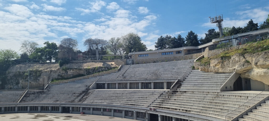
The geological profile “Tašmajdan Miocene Reef” was declared a Category III protected natural asset of local importance as the Natural Monument “Tašmajdan Miocene Reef” on November 29, 2021 (Decision 501-918/21-с).
The Natural Monument “Tašmajdan Miocene Reef” was designated a protected area as a geological profile composed of organogenic-reef limestones of Badenian age, formed as a reef through the biological activity of red colonial algae, corals, foraminifera, and colonial bryozoans, and contains abundant fossil fauna.
The remaining part of the Tašmajdan Miocene Reef quarry represents the only physical testimony of a past era in the urban development of this part of Belgrade, giving it significant cultural and historical value. The connection of the cliff section with “Löhr’s Shelter” from World War II and the still unexplored and unevaluated underground passages further enhances the importance of the protected area.
The Natural Monument “Tašmajdan Miocene Reef” is located in the territory of the City of Belgrade, at 28 Ilije Garašanina Street, in the Palilula municipality (cadastral plot 1953/2 KO Palilula). It is bordered by Aberdareva, Ilije Garašanina, and Beogradska streets, while to the west it adjoins Tašmajdan Park, which opens onto King Alexander Boulevard.
The total protected area covers 2 hectares and 46 ares and is state-owned. Protection regimes of Levels I, II, and III have been established. Level I protection regime (0.12 ha) encompasses the slope and visible part of the reef from the open swimming pool to the waterworks facility. Level II protection regime (0.43 ha) covers the slope between the upper edge of the reef and the edge of Tašmajdan Park, parts of the rock below the stadium stands, and underground chambers (“Löhr’s Shelter” and unevaluated medieval corridors). Level III protection regime (1.90 ha) covers the remaining part of the protected natural asset not included in Levels I and II.
Under Level I protection, strict preservation of the reef itself is enforced through maximum conservation of the existing condition, prohibiting any reduction of its visible or built surface. Level II protection involves active preservation, allowing interventions aimed at restoration and overall improvement without damaging primary habitat values, species populations, ecosystems, landscape features, and geoheritage sites, while restoring traditional activities in a sustainable, strictly controlled manner. Level III protection involves proactive measures, permitting activities aimed at restoration, revitalization, landscaping of cultural-historical heritage sites, and general enhancement of the protected area.
Download:
- 2025 Annual Monitoring Report for the Tašmajdan Ridge
- 2024 Annual Monitoring Report for the Tašmajdan Ridge
- 2023 Annual Monitoring Report for the Tašmajdan Ridge
- 2022 Annual Monitoring Report for the Tašmajdan Ridge
- Protected Area Management Plan...
- 111-2021 Official Gazette of the City of Belgrade
- Miocene Shoal Protection Study 2014